
Mount Umunhum: A Trail Guide
Mount Umunhum is one of the most rewarding hikes in the South Bay, offering beautiful forest trails, a steady climb, and spectacular panoramic views from the summit.
The summit is dominated by the distinctive concrete structure known as "The Cube." It was built as part of the Almaden Air Force Station during the Cold War and housed a radar system used to monitor the skies for potential enemy aircraft. The station operated from 1958 to 1980, and the Cube remains as a reminder of that era.
The hike is about 8 miles round trip, with plenty of interesting spots along the way. Here are some practical tips to help you plan your hike, avoid common parking mistakes, and make the most of your day on the trail.
AllTrails: https://www.alltrails.com/trail/us/california/mount-umunhum
1. Parking: Read This Before You Go!
- Follow AllTrails directions or search for Sierra Azul Bald Mountain Parking Lot on Google Maps.
- The parking lot gate officially opens at 7 AM. Street parking is not allowed, though often the gates are open by 6:30 AM.
- Important: Do not park at the first "Sierra Azul" lot near the Hicks Road and Mt. Umunhum Road intersection. Continue another 1.7 miles up Mt. Umunhum Road to the next "Sierra Azul" lot. This is the correct starting point.
- On summer weekends, the lot can fill up by 8:30 AM.
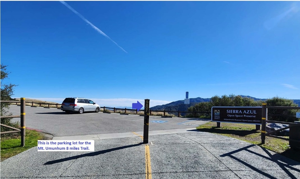
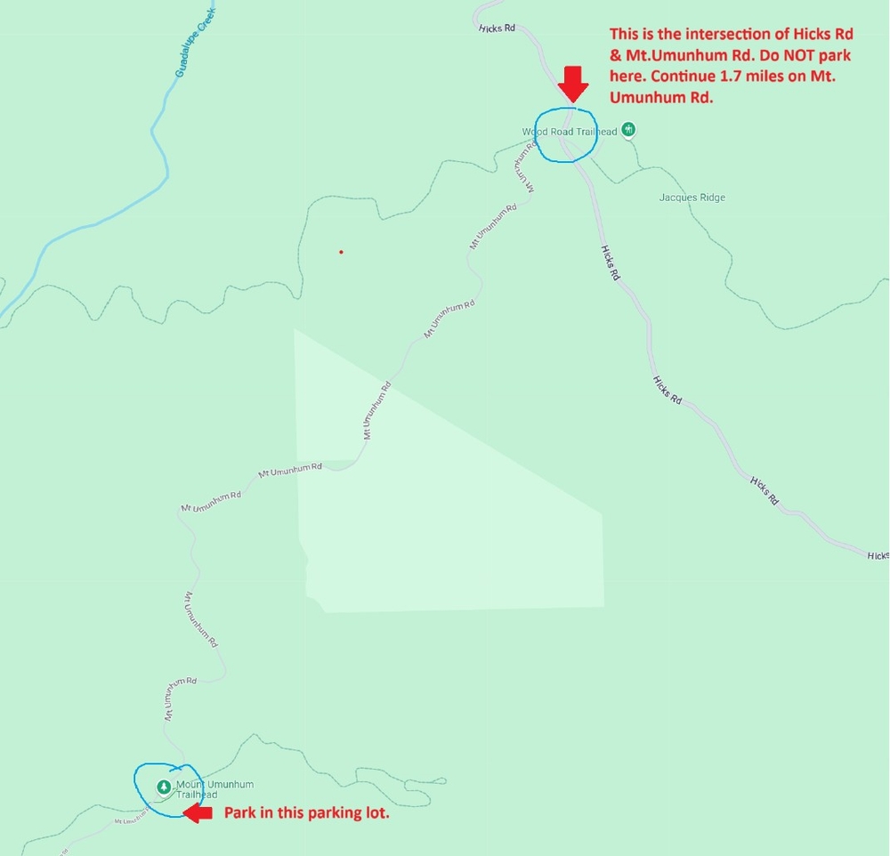
What if the parking lot is full?
Drive another 3.6 miles (about 15 minutes on the winding road) to the summit parking lot. It has plenty of parking and is a convenient alternative. The trade-off? You'll see the spectacular views first and hike downhill, rather than earning those views with the climb!
Parking lot hours: Entry closes at sunset, but you can exit anytime. The gate opens outward after sunset.
2. Before You Go
A little preparation will save you some trouble:
- Check trail closures: Visit the Trail Closures Info page before heading out. Closures often occur on weekdays for wildlife or habitat studies.
- Check for events: Google the trail name along with terms like "race" or "marathon." Organized events can affect trail access.
- Download Google Maps offline: Cell service is generally fine along the trail but can be spotty at the parking lot. I have found the GPS location on Google Maps spinning endlessly just when I needed it to navigate back!
3. Trail Details
- Distance: Approximately 8 miles round trip (4 miles each way).
- Difficulty: Easy to moderate, with a steady gradient.
- Shade: Approximately 85% shaded.
- Toilets: Vault toilets at the Bald Mountain parking lot and summit.
- Water: No water available along the trail. Carry your own.
4. Interesting Spots Along the Trail
A few things to look out for as you make your way to the summit:
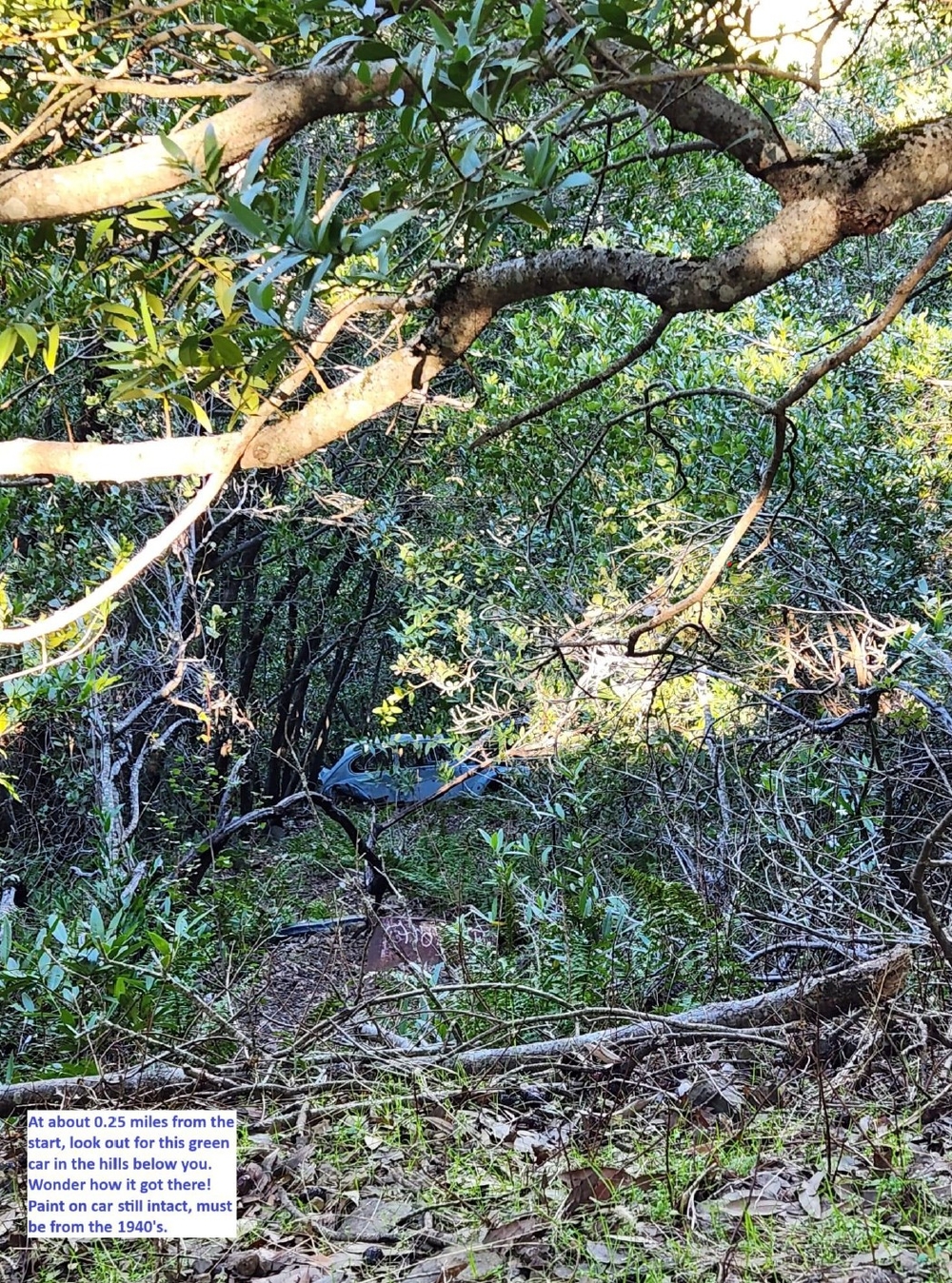
- The Old Green Car (0.25 miles from the start): Look down into the trees and you'll spot an old green car. Wonder how it got there and, more remarkably, why its light green paint is still intact!
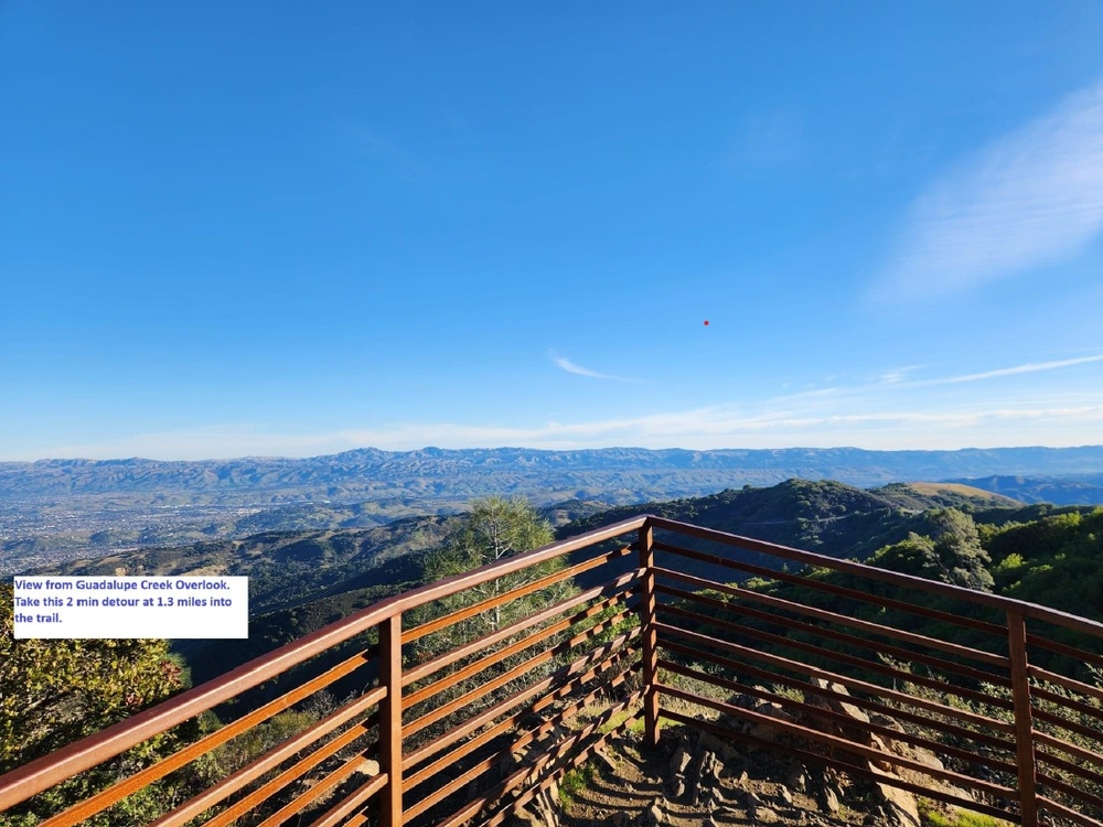
- Guadalupe Creek Overlook (1.3 miles from the start): Don't miss this quick two-minute detour. It's a wonderful photo opportunity with beautiful views.
- Near the summit: You'll come across signs indicating:
- 0.1 mile to Summit Parking
- 0.2 miles to Mt. Umunhum Summit
- Take one route on the way up and the other on your way down for a little variety.
5. Stay on the Right Trail
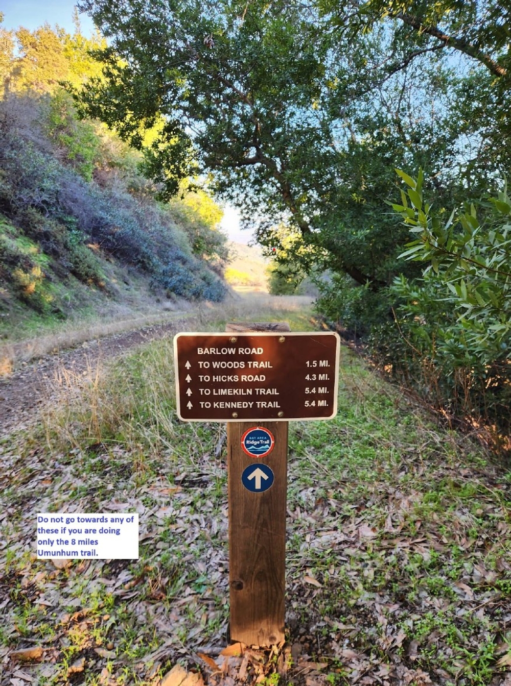
There are several connecting trails in this area, so pay attention to the trail signs.
Stick to trails marked:
- Mt. Umunhum Trail
- Mt. Umunhum Summit
- Bald Mountain Parking Lot
- Guadalupe Creek Overlook
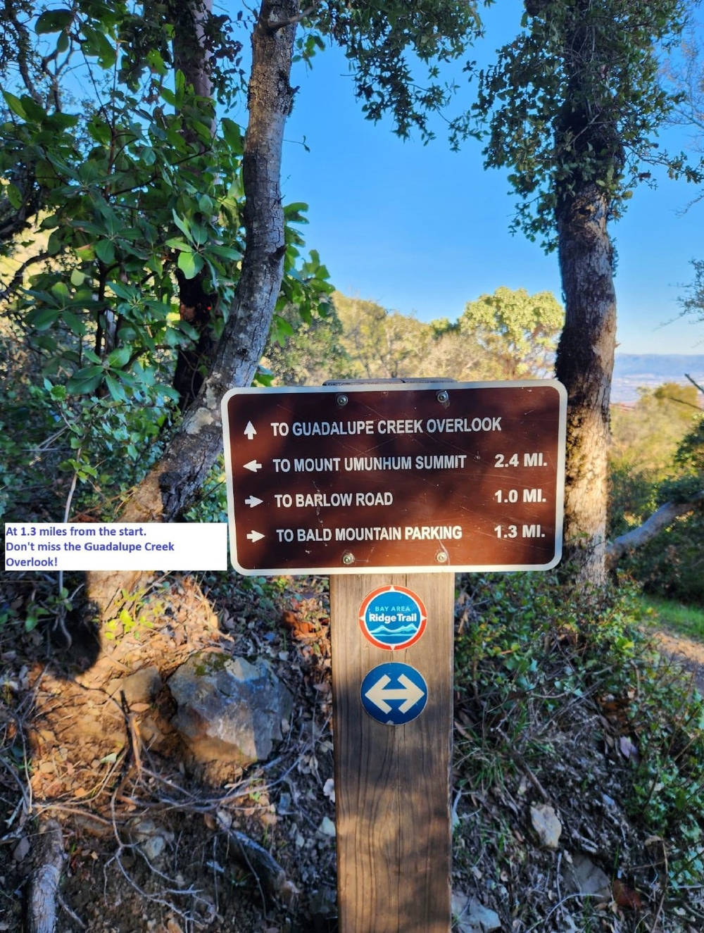
- Avoid taking Barlow Road, Woods Trail, or Kennedy Trail if you're following this particular route.
6. The Summit: The Cube & The Views
The cube at the summit is a little underwhelming, but the panoramic views are absolutely worth the climb!
One mystery remains: the USGS marker. I've never managed to find it. Is there one? If you've spotted it, I'd love to know where!
7. Bonus Hike: Bald Mountain Trail
Still have some energy left? Add the Bald Mountain Trail to your day.https://www.alltrails.com/trail/us/california/bald-mountain-trail--3
- Distance: 1.3 miles round trip.
- Starting point: The same Bald Mountain parking lot. The trail gate is at the far end of the lot, walking away from the vault toilets.
- Why go: Stunning views make this a worthwhile addition.
Complete both hikes and you'll have covered approximately 10 miles for the day!
Whether you stop at Mount Umunhum or add the Bald Mountain Trail for a longer day, this hike is well worth exploring. The shaded trails, interesting sights along the way, and spectacular summit views make it a wonderful outing in the South Bay.
—
Fatima
————————————————————————————————————————————————————————
Interested in exploring outdoors with others? Discover upcoming outdoor experiences.